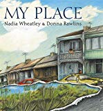
‘My Place’ was first published in 1987, the year before the Australian Bicentenary, then republished in 2008 and 2018. It continues to be published.
It celebrates 30 years of lively and engaging moments in history that have relevance to children. The story focusses on one inner west Sydney street as seen through the eyes of the culturally diverse children who lived there. The standout feature of this book is the maps, drawn by children, illustrating their place in time and in both the specific and wider world at the time.
The narrative, revealed through the eyes of the young people living there, documents residents’ lives every ten years, over a 200-year period. The story opens in 1988 with 10-year-old Laura proudly pointing out the Koori flag in her window that ‘shows we’re on Aboriginal land … I think it means the colour of the earth back home’.
The detailed illustrations invite multilayered reading of historical detail including waves of migration, the effects of two world wars and visible deterioration in some homes after the Great Depression. These are all told from the vantage point of young people. Changing land use and the effects of urbanisation are reflected in the children’s hand drawn maps, with their personal annotations. The constant geographical features are the big tree and the creek, gradually polluted then eventually developed into a canal. There is enormous potential for discussion of many aspects of Australian history with a great strength that this story is told from various children’s perspectives.
Throughout the narrative the disruption of colonisation renders Laura’s people invisible. However, the 2008 edition timeline references the Mabo and Wik Judgements, recognising ‘Aboriginal people as the traditional owners of Australia’, highlighting ‘my place’ as home in 1788 for Barrangaroo, who reveals, ‘My grandmother says we’ve always belonged to this place. ‘But how long?’ I ask. ‘And how far?’ My grandmother says, ‘For ever and ever’.

